EN
weather-logo
71°
Now
weather-logo
71°
ocean

(Updated: 4/8/2024)

Beach Status

Please be aware that our area is still recovering from Hurricane Ian (2022) and some locations may look different right now. Check out our list of open beaches below. Please note that all parking fees are now through a mobile payment system.

Open Beaches

  • San Carlos Bay-Bunche Beach Preserve (Fort Myers) - $2/hour
  • Lynn Hall Memorial Park (Fort Myers Beach) - $2/hour 
  • Bowditch Point Park (Fort Myers Beach) - $2/hour
  • Crescent Beach Family Park (Fort Myers Beach) 
  • Lovers Key State Park (Bonita Springs) - $8/vehicle for the day
  • Fort Myers Beach Accesses #11-14; #16; #19-24; #27-28; #30 & #36 - $5/hour
  • Lighthouse Beach Park (Sanibel Island) - $5/hour
  • Blind Pass Beach (Sanibel Island) - $5/hour
  • Bowmans Beach (Sanibel Island) - $5/hour 
  • Gulf Side City Park (Sanibel Island) - $5/hour
  • Tarpon Bay Road Beach (Sanibel Island) - $5/hour
  • Turner Beach (Captiva Island) - $5/hour
  • Alison Hagerup Beach Park (Captiva Island) - 1 hour - $15, 2 hours - $25, all day (dawn to dusk) - $40
  • Gasparilla Island State Park
  • Boca Grande Beach Accesses
  • Dog Beach (Bonita Springs)
  • Bonita Beach Park and Bonita Beach Accesses 1-10 (Bonita Springs) - $2/hour
  • Little Hickory Island Park (Bonita Springs)
  • Yacht Club Beach (Cape Coral)
  • Cayo Costa State Park (only accessible by private boat)

Currently Closed:

  • Newton Park Beach (Fort Myers Beach)
  • Causeway Island Parks (Sanibel Causeway)

For more information on additional openings and available amenities, use this interactive map to learn about specific locations.

Know Before You Go:

  • Some beaches and beach parks have not been restored to pre-Hurricane Ian conditions.
  • Facilities and beach accesses are limited (you may need to walk further than you used to).
  • Some amenities such as restroom facilities, piers, and walkovers have not been repaired or replaced at this time. Many beaches have temporary restrooms available.
  • Beach/water shoes are recommended.
  • Closure signs are posted where necessary so we ask you to please adhere to these cautions.
  • Please respect posted wildlife areas and dune vegetation.
  • Swim at your own risk.

woman floating in blue water from aerial view above beach

Explore Our Beaches

Learn more about the beaches in the Fort Myers area.

Beach Parking Fees

Beach Parking Fees for Sanibel & Captiva Islands

Beach parking pay stations are no longer available on City of Sanibel beaches or Captiva Island beaches.

  • Sanibel: For patrons who do not possess a City of Sanibel Beach Parking Permit or a Lee County Parking sticker (only valid at Bowman's Beach), paid parking must be processed through the City of Sanibel's new mobile pay system. Learn more here.
  • Captiva: Visitors parking at the Captiva Island North Lot (Alison Hagerup Beach Park) will need to download the ParkMobile app. Get more info here. The park and pay stations are maintained by the Captiva Erosion Prevention District. Parking proceeds are applied directly to beach nourishment and the enhancement of wildlife habitat.

Within Lee County, some beaches are owned and managed by municipalities and the state. Please visit the following websites for more information:


Beach Parking Fees for Fort Myers, Fort Myers Beach & Bonita Springs:

A new parking payment system, Text2Park is in effect at select Lee County beach locations to allow patrons the convenience to pay for parking from their mobile device. 


The updated system features a convenient, cashless pay-by-plate system. This means visitors will no longer need to visit a kiosk or display a parking receipt on the dashboard of their vehicle. Directions will be displayed on each parking space sign. Parking is $2 per hour, with the ability to add additional time. 


The beach locations implementing pay-by-plate parking are:

•    Bonita Beach Park, 27954 Hickory Blvd., Bonita Springs
•    Bonita Beach Access #1, 27890 Hickory Blvd., Bonita Springs
•    Bonita Beach Access #10, 26082 Hickory Blvd., Bonita Springs
•    Bowditch Point Park, 50 Estero Blvd., Fort Myers Beach
•    Lynn Hall Memorial Beach Park, 950 Estero Blvd., Fort Myers Beach
•    San Carlos Bay-Bunche Beach Preserve, 18201 John Morris Road, Fort Myers

Park staff will be available throughout the rollout of this system to assist guests and a video explaining the new pay-by-plate process will be available at www.leeparks.org/beaches.
 

Red Tide

At this time, there is no sign of Karenia brevis, the organism that causes red tide, in our area.

See a map where water quality samples were taken by clicking here. TIP: Click on a specific point on the map to see the date the sample was taken. We encourage all beachgoers review this daily sampling map prior to visiting their preferred beach park facility.

We highly advise that you use the resources listed below before planning to visit our beaches. Red Tide can affect your beach experience and it is important to know which beaches are being impacted prior to your visit. These conditions do change daily and we advise you to stay informed.

The most recent Red Tide Report from the Florida Fish and Wildlife Conservation Commission can be seen here.

The Red Tide Respiratory Forecast Tool from the Gulf of Mexico Coastal Ocean Observing System (GCOOS) can be seen here.

See a map from Mote Marine Laboratory with current beach conditions here.

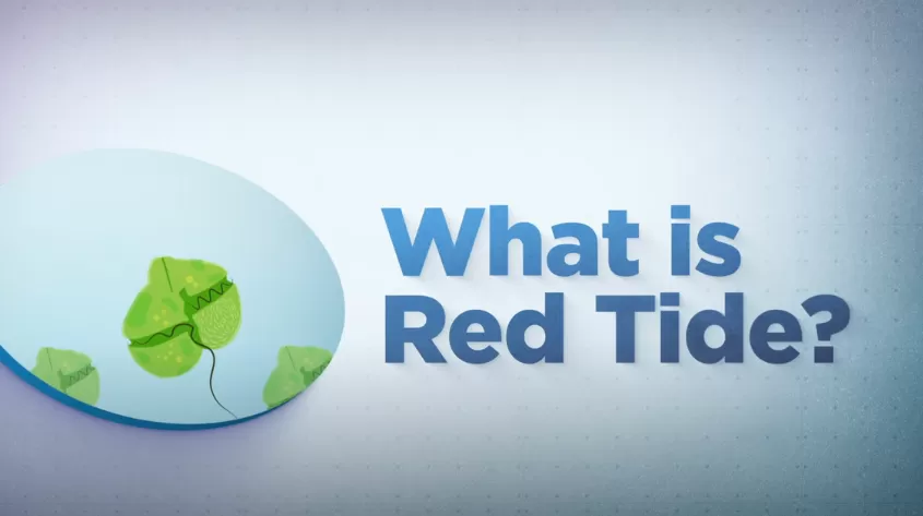
What is Red Tide?

In this video, learn about red tide's life cycle, what causes "blooms", what areas of Florida are affected by red tide, and more.

Additional Resources


Beach Conditions & Water Quality

Beach Conditions Reporting System (Mote Marine Laboratory) - Map displaying beach conditions reports from participating locations

Red Tide Current Sampling Map - Updated bi-weekly by The Florida Fish & Wildlife Conservation Commissions (FWC)

Florida Healthy Beaches Program (Florida Department of Health) - Map with beach samples & advisory status

Sanibel-Captiva Conservation Foundation (SCCF)- A local foundation dedicated to the conservation of coastal habitats and aquatic resources on Sanibel and Captiva islands and in the surrounding watershed.

Algal Bloom Sampling Status - Interactive dashboard allows public to see where algal blooms were occurring in Florida. It features real-time updates, photos and information. Users can search by specific address, ZIP code, city or place. The tool includes quick links to other resources such as public health information. 

Gulf of Mexico Coastal Ocean Observing System (GCOOS) - This is an experimental forecast of potential respiratory irritation that may occur because of airborne toxins produced by the red tide organism Karenia brevis. It indicates a greater or lesser likelihood of negative conditions based on predicted wind and ocean currents. Please NOTE: This experimental forecast is currently being tested for efficacy and is not yet an official forecast. Daily availability of the product cannot be assured.

 Lee County's Water Quality Information